Discovering Uzbekistan’s Eastern Jewel: Namangan and The Fergana Valley
On the eastern end of Uzbekistan, guarded by the majestic rock face of the Tian Shan Mountains, lies the Namangan region. Spread along the northern part of the Fergana Valley, the region is a long and expansive canvas of breathtaking landscapes, tradi- tions and crafts, as well as other historic and natural attractions.
The Fergana Valley is a geological depression that extends for more than 300 km in length and 70 km in width, and is lodged between the Tian Shan Mountains to the north, and the Gissar-Alai range to the south. Irrigated by tributaries of the Syr Darya river, the region is one of the most fertile parts of the country. The richness of the soil attracted agricultural interest and over the centuries several settlements began to sprawl in the valley. These towns and villages gave rise to Silk Road trading posts, fortifications, and to the 19th-century Khanate of Kokand, close to the present day Tajikistan.
About 430 km east of Tashkent, in the northern end of the Fegana valley, lies the city of Namangan. Less than 30 km away from the border with Kyrgyzstan, it is the third largest city in the country after Tashkent and Samarkand. A 55-minute flight from Tashkent, Namangan’s airport is located 12 km west of the city. There are no direct buses from Tashkent, but Andijan (1hr) and Fergana (2hrs) have regular departures. Namangan’s urban area developed just north of the confluence of the Karya Darya and Naryn rivers, both tributaries of the Syr Darya, also known as Jaxartes, a watercourse that meanders for several hundreds of kilometers before reaching the Aral Sea in western Uzbekistan. In the outskirts of the city, a line of lush hills colors the horizon, where fruits and vegetables are grown with water from the North Fergana Canal. After the arrival of the Russians in the late nineteenth century, cotton growing and processing has remained a key industry.
The city offers a wide variety of attractions, including the Babur Park located in the center of town, where one can go for a stroll and take a short respite from the bustle of the streets. It is a haven of peace and quiet for many. Old sycamore trees extend their branches to offer the gift of a cool, pleasant shade to more than one passerby. Men drinking tea, hunched over their chess boards can be seen along the edges of the park, others playing nards, a Persian board game that resembles backgammon. Named after the descendant of Timur and Genghis Khan, the park was founded in 1884 as the garden of the Russian gover- nor. Zahir-ud-din Muhammad (1483-1530), also known as Babur, was born in the adjacent province of Andijan. In 1504, not much older than twenty, he captured the city of Kabul for the first time, then in 1510 again. On the plains of the Punjab, in 1526, the Indian armies were defeated at the battle of Panipat and Babur marched triumphantly over Delhi.
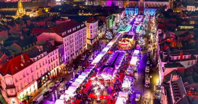
For those wanting to visit a museum in the area, not far from Babur’s Park, at 25 ex-October Street, the Namangan Natural History Museum holds a collection of archaeological artifacts from the region. If one continues east, the pedestrian avenue Uychi leads to the beating heart of this area: the bazaar. Behind mountains of fruits and vegetables, smiling sellers offer the best of their produce. Over extended pieces of cloth, craftsmen display wooden cradles painted in bright colors, white-haired women knit long tablecloths in their lap, they sell embroidered skullcaps and woolen shawls.
The city of Namangan is home to a large set of remarkable reli- gious constructions and schools. The Mullah Kyrgyz Madrassa was built in 1910, and named after the architect who designed it, Usto Kyrgyz. The religious school remained closed during the Soviet era and is now a museum-monument, housing the Soviet literary museum. The ceilings and columns display fine carved woodwork, and the portal is decorated with colored mosaics with motifs of flowers in green, yellow and white. Not far from there, stand the Khodjamni Kabri Mausoleum and Khodja Amin Mosque, both works by the 18th century architect Usto Muhammad Ibrahim. The terracotta tilework on the front portico is unusual and intricate, the tiles being produced in an old-fashioned style resembling the methods used in the 12th century. Further east one can find the Ota Valikhon Tur Mosque, which was built in 1915, decorated with blue mosaics and star-like shapes that contrast with the Arabic calligraphy decorating some of the walls.
About 20 km southwest of the city lie the ruins of Aksikent, a fortified town at the confluence of the Syr Darya and Kasansai rivers. Known as Akhsi, the hamlet had been established by the 3rd century BC. It functioned as a caravan stop for travelers going from Kashgar to Byzantium. The strong but flexible steel produced in the smelting furnaces of Aksikent was famous as far away as Damascus. By the early middle ages, the town had flourished to such an extent that an 18km-long wall was built around the main citadel. Very little remains of this once important traveling post, but from the top of a mound located in the middle of the current site, one can get a view of what was once the center of the fort. In the Baburnama, Emperor Babur’s memoirs, he described how the suburbs of Aksikent could be seen as far as 3 km into the distance.
For many travelers, the jewel in the region is the city of Chust. At about 30 km west of Namangan, Chust is the cradle of some of the finest works of craftsmanship in the country: the Uzbek national knives and the embroidered skullcaps. In the National Knife Factory, located at 46 Chusti, one can see the blacksmiths at work, hammering and grinding knives of different lengths, made either of steel or iron. As the tradition dictates it, the tip of each knife must curl in a particular way at a certain angle, a secret only these craftsmen are privy to
The haft or knife handle is carved with intricate, beautiful patterns that only come out after several hours of precise work by an experienced master carver. Some have incrustations of mother-of-pearl arranged in flower-like shapes; others are carved from animal horn. The tubeteika is a black tetrahedral skullcap typical of the Fergana Valley, with Chust being one of its main production centers. Unlike the knives, the production of tubeteika is the activity where women display their creativity, and the skills that have been passed down generation after generation. Each skullcap has a black base which is then embroidered in white. The four arches are meant to symbolize the unassailable gates that will dissuade the enemies from any incursion; the peppers are protection against evil eye; and the almonds are the gift of life and fertility. Like Namangan, the city houses several cotton mills and the industry is an important pillar of the city’s economy. Another garment which is part of the national attire, is also produced in the Namangan region and is made of beqasam. A silk fabric with stripes in different bright colors, it can be seen in many Uzbek festivals and national celebrations.
For those wanting to get away from the city, the town of Chortoq offers a bath in the calming mineral waters of its many resorts. Located only 23 km northeast of Namangan, Chortoq can be the ideal destination to end the tour of the region.